© 2010 Bruce V. Bigelow, editor of Xconomy San Diego.
You can e-mail him at bbigelow@xconomy.com or call 858-202-0492
Octobers have been cruel to San Diego.
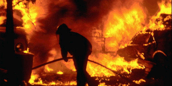
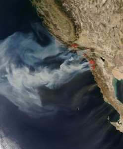
The infamous Cedar Fire started on a Saturday evening, Oct. 25, 2003, and raced more than 30 miles from the Cleveland National Forest into the San Diego suburbs by the next morning. The firestorm destroyed 2,232 homes and killed 15 people before it was contained nine days later. Then there was the Witch fire of 2007, part of a cluster of wildfires that erupted on October 21, killed seven, and destroyed 1,500 homes and forced the evacuation of 500,000 residents throughout San Diego County. That was a bigger evacuation than in New Orleans in 2005, whenHurricane Katrina attained its dubious distinction as the costliest natural disaster in U.S. history.
Still, we’re getting better at dealing with firestorms in San Diego—and natural disasters in general—as innovations in sensor technologies, wireless networks, and predictive analytics have helped provide more accurate forecasts and better warnings. And much of the technology is being developed in San Diego.
Earlier this month, for example, San Diego Gas & Electric officials held a press briefing to explain that the utility had spent $1.1 million over the past year to add 93 anemometers (for measuring wind speed) to an existing network of 16 radio-automated weather stations throughout San Diego County. As a result, San Diego County now has the densest network of weather instrumentation in the country, according to Brian D’Agostino, a full-time weather forecaster hired by SDG&E last year.
The increased instrumentation gives SDG&E’s operations center more detailed information about wind conditions in specific locales. Utility regulators allow SDG&E to shut off power to specific transmission lines when local wind speeds exceed 56 mph, according to Dave Geier, SDG&E’s vice president of electric transmission and distribution. Wind speeds above 56 mph increase the odds that blowing debris or swaying trees will bring down a power line, according to utility officials.
A more sophisticated wireless sensor network, such as the High Performance Wireless Research and Education Network developed by researchers at UC San Diego, serves as a model of the type of network that could provide even more data, including imagery, that could help in the prediction of and response to disasters, according to Hans-Werner Braun of the San Diego Supercomputer Center. With funding from the National Science Foundation, Braun says the network demonstrates how a remote sensing systems can be effectively networked throughout remote areas of San Diego, Riverside, and Imperial Counties. Braun, who is overseeing the project, has described it as a wireless backbone that uses Internet routers on mountaintops, interconnected via wireless links.
Braun, who was the chief network architect for the satellite network conceived by Bellevue, WA-based Teledesic in the 1990s, uses the system for his own research on improving the performance and quality of wireless-based networks. Fire agencies use the network for wildfire communications and data collection; teachers use it for remote education; and scientists for remote environmental sensing for their research in seismology, astronomy, and other fields.
The sensor data and images collected from such networks are coming together in places like the Immersive Visualization Center of the Geography Department at San Diego State University, which proved to be a key coordinating center during the 2007 firestorms. An avalanche of real-time imaging, including infrared views and sensor data from satellites, military aircraft, and other sources flowed into the lab, which became the nexus of a voluntary, Web-based, wildfire mapping effort.
It was the first time that civilian fire departments had worked so closely with the Department of Defense and National Guard, according to a report in The San Diego Union-Tribune a few weeks later. “We were working with some of the highest-tech equipment the military has, the same stuff they’re using in Iraq ,” state Fire Marshal Kate Dargan told the newspaper. The images came mostly from a host of manned and unmanned military surveillance planes, including a Predator surveillance aircraft assigned to NASA and a high-altitude Global Hawk spy plane operated by the Air Force, as well as video from local police and fire helicopters.
Eric Frost, an associate professor of geological sciences who co-directs the “VizLab” at SDSU, told me he was particularly struck by images from the Predator as it flew 10-hour missions over the inferno. Using radar technology that penetrated thick clouds of smoke, the Predator showed how ember “showers” from the firestorm were igniting new fires far ahead of the main wall of flames—and well behind the firefighters working on the fire line to halt the blaze.
Since then, the VizLab has worked to help emergency response teams in other natural disasters, including the catastrophic magnitude 7 earthquake that struck Haiti on January 12 and the Gulf oil spill that followed the April 20 explosion and sinking of the Deepwater Horizon offshore drilling rig. In the process, Frost says the VizLab became part of a group of hundreds to thousands of people called the Crisis Commons, which operates as an open-source effort to use the tools of information technology to help authorities respond to the Jan. 12 quake in Haiti , and other disasters and emergencies. During the oil spill, for example, Crisis Commons developed a free cellphone app to help crowd-source real-time data and imagery of the crude oil spill along the Louisiana coast.
Frost tells me the VizLab also is working to make it easier to incorporate “crowd-sourcing” images from smartphones and other mobile devices that include the date, time, location, and textual information into the Web-based disaster maps they’re creating. In a recent exercise, for example, the VizLab worked with the help of companies such as Charlotte, NC-based Sports Media Challenge, which uses a social media mining service called Buzz Manager to monitor and aggregate messages from various social media platforms and forward them to the appropriate organizations.
A small Unmanned Aerial Vehicle (UAV) with a 4-foot wingspan also has proved extremely useful for aerial surveillance of wildfires and other disasters, Frost tells me in a recent e-mail. The aircraft, which is being developed by SDSU researcher Mike Hennig, can provide high-resolution images, fly in windy conditions considered unsafe for helicopters, and is far cheaper to operate, Frost says. “The idea is to rapidly gather high-resolution imagery and be able to send back out to firefighters and others on Mobile Data Computers or smartphones.”


