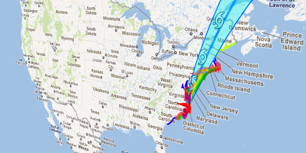
Hurricane Irene is an Atlantic hurricane that inflicted extensive damage to Caribbean nations before making landfall in North Carolina, United States. It is currently threatening the Mid-Atlantic and New England regions of the United States as well as eastern Canada. The ninth named storm and both the first hurricane and major hurricane of the 2011 season, Irene formed from a well-defined Atlantic tropical wave, that showed signs of organization east of the Lesser Antilles. It developed atmospheric convection and a closed cyclonic circulation center, prompting the National Hurricane Center to initiate public advisories on the tropical cyclone late on August 20. Subsequent convective organization occurred as it passed the Leeward Islands, and by August 21, it moved very close to Saint Croix. The next day Irene made landfall near Puerto Rico, where high winds and intermittent torrents caused significant property damage.
The hurricane strengthened as it passed through The Bahamas, becoming a major hurricane while doing so and causing extensive damage to the islands. Curving toward the north, Irene skirted past Florida with its outer bands producing tropical-storm-force winds. It made landfall over North Carolina’s Outer Banks on the morning of August 27. Throughout its path, Irene caused widespread destruction and at least seven deaths; monetary losses could be as high as US$3.1 billion according to preliminary estimates.
[source: Wikipedia]


